The International Boundary and Water Commission, United States and Mexico (IBWC) is a bilateral government body charged with maintaining border and water agreements along the international border between the United States and Mexico. The commission’s American section (USIBWC) is overseen by the State Department, and its origin dates back to the 19th century. The USIBWC’s structure and many functions are defined by treaties signed during the first half of the 20th century.
Some experts have argued that the commission is long overdue for change, and recently the US side of the IBWC was engulfed in controversy stemming from the leadership of its top official, an appointee of President George W. Bush.
The border between the United States and Mexico, stretching almost 2,000 miles from California to Texas, was first established under the 1848 Treaty of Guadalupe Hidalgo (PDF). The border was further refined under the Gadsden Treaty of 1853 (PDF), which reestablished the southern boundary of New Mexico and Arizona to enable the US to construct a railroad to the west coast along a southern route.
Both treaties established temporary joint commissions to survey, map and demarcate with landmarks the boundary between the US and Mexico. The Convention of 1882 (PDF) established another temporary joint commission to resurvey the western land boundary between the Rio Grande and the Pacific Ocean, rebuild the old monuments and install additional monuments where necessary. During the late 1890s, US and Mexican commissioners resurveyed the borderline and increased the number of boundary monuments from 52 to 258. This survey started at the El Paso, Texas – Ciudad Juárez, Chihuahua border in 1891 and concluded at the San Diego, California – Tijuana, Baja California border in 1894. As border populations increased during the 1900’s, the commission installed 18 additional boundary monuments for a total of 276.
As the settlements grew along the boundary rivers of the Rio Grande and Colorado River, settlers began developing adjoining lands for agriculture. In the late 1800s, questions arose as to the location of the boundary and the jurisdiction of lands when the boundary rivers changed their course and transferred land from one side of the river to the other. As a result, the US and Mexico adopted rules to deal with such questions in the Convention of 1884 (PDF).
The U.S. and Mexico established the International Boundary Commission (IBC) on March 1, 1889, as another temporary body to enforce the rules from the 1884 agreement. The IBC was extended indefinitely in 1900 and is considered the direct predecessor to the modern day IBWC. The 1884 Convention was modified by the Banco Convention of March 20, 1905 (PDF) to retain the Rio Grande and the Colorado River as the boundary.
As border populations increased during the early to mid 1900's, the commission faced many new challenges. The US and Mexico used studies developed by the IBC as the basis for the first water distribution treaty between the two countries, the Convention of March 1, 1906 (PDF), which allocated the waters of the Rio Grande from El Paso to Fort Quitman. This convention allotted to Mexico 60,000 acre-feet of water annually (an acre foot of water is equal to 325,851 gallons of water). To facilitate this water delivery, the US constructed the Elephant Butte Dam in its territory. The convention included a provision that in case of extraordinary drought or serious accident to the irrigation system in the U.S., the 60,000 acre-feet allotment can be reduced.
In the Convention of February 1, 1933 (PDF), the two governments agreed to jointly construct, operate and maintain, through the IBC, the Rio Grande Rectification Project, which straightened and stabilized the 155-mile river boundary through the highly developed El Paso-Juárez Valley. The project further provided for the control of the river's floods through the valley.
The IBC was also instrumental in developing the second water distribution treaty between the United States and Mexico in 1944, which addressed utilization of the waters of the Colorado River and Rio Grande from Fort Quitman, Texas to the Gulf of Mexico. The Water Treaty of February 3, 1944 (PDF) is one of the most important treaties affecting the boundary commission. With the signing of this treaty, the IBC was renamed the International Boundary and Water Commission (IBWC). It also expanded the commission’s duties and made changes to its leadership structure.
Pursuant to the 1944 treaty, the IBWC has the status of an international body and consists of a United States Section and a Mexican Section. Each section is headed by an engineer commissioner and includes two principal engineers, a legal adviser and a secretary who are entitled diplomatic privileges and immunities. The IBWC and its personnel may freely carry out their observations, studies and field work in the territory of the other country. Wherever there are provisions for joint action or joint agreement of the two governments or for the furnishing of reports, studies or plans, it is stipulated that those matters will be handled by the US State Department and the Ministry of Foreign Relations of Mexico.
The 1944 treaty further provided for the two governments to jointly construct, operate and maintain dams on the Rio Grande required for conservation, storage and regulation of water. Furthermore, the 1944 treaty established a guaranteed annual quantity of 1.5 million acre-feet to Mexico, and authorized the construction of a canal by Mexico to divert water from the Colorado River below the point where the California-Baja California land boundary line intersects the river. It also provided for the construction of flood control facilities, at Mexico’s expense, to protect US lands from floods that might result from the operation of the diversion canal.
Other key agreements include the Chamizal Convention of August 29, 1963 (PDF), which resolved a 100-year-old boundary dispute between El Paso and Juárez, Chihuahua. The Treaty of November 23, 1970 (PDF) included provisions for restoring and preserving the character of the Rio Grande, to minimize changes in the channel and to resolve problems of sovereignty that arise due to future changes in the channel.
The IBWC is a bilateral entity created by the United States and Mexico to administer boundary and water-rights treaties between the two countries. Article 2 of the 1944 water treaty stipulates that each national section of the IBWC will be comprised of a commissioner with the rank of ambassador and full diplomatic privileges who must also be a licensed engineer. The treaty also calls for a secretary, two principal engineers and a legal advisor for each section of the IBWC. More information about these positions can be found here.
The role and duties of the American and Mexican sections of the IBWC are to administer the provisions of treaties and to interpret and resolve differences between the two nations related to the treaties. A synopsis of international treaties and agreements involving the IBWC is here. The American office also makes available copies of its reports and studies.
Most of the work performed by the US section of the IBWC breaks down into areas involving flood control, water storage and water quality. The American office participates in several flood control projects along the Rio Grande and the Tijuana River. Since 1967 the commission has worked on a joint project for the control of floods on the Tijuana River for protection of developments near San Diego and in the City of Tijuana, Baja California. The Rio Grande Canalization Project (PDF) provides flood protection against a 100-year flood and assures releases of waters to Mexico from the upstream reservoirs in accordance with the 1906 Convention. The commission is also involved in a study of the Lower Rio Grande (PDF) flood control project which has been in effect since the 1930s.
Numerous dams exist along the waterways that help make up the border. The commission works with officials who operate diversion dams and storage/hydroelectric dams.
The USIBWC plays a role in maintaining water quality along the border through interaction with three water treatment plants.
The South Bay International Wastewater Treatment Plant is a 25 million gallon per day advanced primary treatment plant located in San Diego County, CA, about 2 miles west of the San Ysidro Port of Entry. The plant treats sewage originating in Tijuana, Mexico and discharges it to the Pacific Ocean through the South Bay Ocean Outfall, a four and one-half mile pipe.
The Nogales International Wastewater Treatment Plant in Arizona is near the Santa Cruz River/Nogales Wash confluence, about ten miles north of Ambos, Nogales. It treats a daily average dry weather flow of approximately fourteen million gallons, of which 70% is from Mexico. Its outdated technology is expected to be replaced through a $60 million upgrade by 2009.
The commission is involved with helping to enforce theTexas Clean Rivers program. In 1991, the Texas Legislature passed the Texas Clean Rivers Act in response to growing concerns about water pollution. Because of the international nature of the Rio Grande, the state of Texas contracted with the USIBWC in October 1998 to implement the Clean Rivers Program for the Rio Grande along its 1,254-mile international boundary section.
Sunland park gate ,put the safety of our country first above politics, secure our border, close the gates, keep America a safe haven for citizens and legal immigrants
Diane McSweeney
7 years ago
You are a government agency paid for by US taxpayers. Millions of Americans want the US/Mexico border closed and the legal immigration process to be followed instead. Millions of us contributed to the newly constructed portion of The Wall because, right
now, it is the only way it will get built. We built it out of our own pockets and demand that you close and lock the gates which you opened purely out of political motivation. CLOSE AND LOCK THE GATES IN THE WALL!!!!!
janet
7 years ago
I'm writing because I want you to take your locks off a private gate built on private land located near Sunland Park, New Mexico. It is over reach to pre-emptively act in this manner. Until your wishes are discussed, negotiated & directives are established,
you have no right to interfere with what private citizens do on their land. Even eminent domain procedures have a timeline and framework that you have violated.
Gary Veazey
15 years ago
I need some assistance and was told your agency was the one to contact. On the Mexican side of the Rio Grande, from Nuevo Laredo to Ciudad Aleman, how many total ranches are there? Thank you.
Gary Veazey
956-717-6473
Cynthia Campbell
15 years ago
The Nogales International Wastewater Treatment Plant is not located in Mexico. It is located near Nogales, Arizona. The facility discharges effluent to the Santa Cruz River and is subject to the treatment and effluent standards of a Clean Water Act permit issued by the State of Arizona.
International Boundary and Water Commission, United States and Mexico
Drusuna, Edward
Comissioner
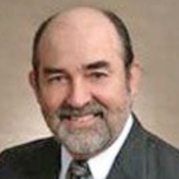
A civil engineer by trade, Edward Drusina has served as the U.S. commissioner to the International Boundary and Water Commission, United States and Mexico (IBWC), since January 19, 2010. The Commission is charged with maintaining border and water agreements along the international border between the United States and Mexico.
A resident of El Paso, Texas, Drusina earned a Bachelor of Science degree in civil engineering from the University of Texas at El Paso in 1974. He is a graduate of the U.S. Army Management Staff College, and is a registered professional engineer in the state of Texas.
He has 20 years of federal experience, holding engineering positions at Davis-Monthan Air Force Base in Arizona and at Fort Bliss, Texas, where he worked for 16 years as chief of Design Br. AA for the Directorate of Public Works and Logistics, and as deputy director of the Source Selection Evaluation Board.
He also worked for the city of El Paso for seven years (1997-2004) as deputy chief administrative officer for municipal services and director of public works, where he oversaw eight departments and divisions responsible for streets, solid waste, engineering, environmental services, building permits and inspections, fleet maintenance, facilities and special projects, and facilities maintenance. From 1998-2004, he represented El Paso on the Far West Texas Water Planning Group.
In 2004 he joined the El Paso engineering consulting company of Moreno Cardenas, Inc. (MCi) as a corporate associate and senior project manager. While with MCi, he served as construction manager for the off-site infrastructure for the world’s largest inland desalination plant, constructed at Fort Bliss.
Drusina was named president of OMNI Construction Services, a newly created subsidiary of Moerno Cardenas, in 2008. He was working as El Paso area director for Paragon Project Resources, Inc. at the time that he was appointed to head the boundary and water commission.
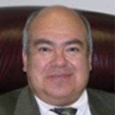
Carlos Marin served from December 2006 as the United States Commissioner of the International Boundary and Water Commission, United States and Mexico. Marin received his Bachelor's Degree in Civil Engineering from the University of Texas at El Paso in 1978. He began his career at the US Bureau of Reclamation where he worked from 1975 to 1979 at offices in El Paso, TX; Denver, CO, and Las Vegas, NV as a civil engineer trainee and as an engineer working on projects such as the Upper Rio Grande Water Conveyance Project and the Pittman Lateral and pump station.
Marin joined the USIBWC in 1979 as a staff engineer. From 1987 to 1989 he was chief of the boundary section in charge of all boundary issues between the US and Mexico, including the 1254-mile Rio Grande boundary and 674-mile land boundary.
From 1989 to 1990 he served as project manager of the Upper Rio Grande Project responsible for flood control and operation and maintenance for the Rio Grande from Percha Dam, NM to Presidio, TX. He also oversaw water deliveries under the 1906 Convention with Mexico. From1990 to 1994 he was project manager of the Nuevo Laredo International Wastewater Treatment Plant, managing design, construction and operation and maintenance of a 31 million gallon per day wastewater treatment plant serving the community of Nuevo Laredo, Tamaulipas. From 1994 to 1997 he served as the commission’s division engineer of planning, project development and operations and maintenance.
Since 1997 Marin has served in various executive positions at the USIBWC, including principal engineer for treaty compliance; principal engineer for the operations department; and deputy commissioner/principal engineer.
The International Boundary and Water Commission, United States and Mexico (IBWC) is a bilateral government body charged with maintaining border and water agreements along the international border between the United States and Mexico. The commission’s American section (USIBWC) is overseen by the State Department, and its origin dates back to the 19th century. The USIBWC’s structure and many functions are defined by treaties signed during the first half of the 20th century.
Some experts have argued that the commission is long overdue for change, and recently the US side of the IBWC was engulfed in controversy stemming from the leadership of its top official, an appointee of President George W. Bush.
The border between the United States and Mexico, stretching almost 2,000 miles from California to Texas, was first established under the 1848 Treaty of Guadalupe Hidalgo (PDF). The border was further refined under the Gadsden Treaty of 1853 (PDF), which reestablished the southern boundary of New Mexico and Arizona to enable the US to construct a railroad to the west coast along a southern route.
Both treaties established temporary joint commissions to survey, map and demarcate with landmarks the boundary between the US and Mexico. The Convention of 1882 (PDF) established another temporary joint commission to resurvey the western land boundary between the Rio Grande and the Pacific Ocean, rebuild the old monuments and install additional monuments where necessary. During the late 1890s, US and Mexican commissioners resurveyed the borderline and increased the number of boundary monuments from 52 to 258. This survey started at the El Paso, Texas – Ciudad Juárez, Chihuahua border in 1891 and concluded at the San Diego, California – Tijuana, Baja California border in 1894. As border populations increased during the 1900’s, the commission installed 18 additional boundary monuments for a total of 276.
As the settlements grew along the boundary rivers of the Rio Grande and Colorado River, settlers began developing adjoining lands for agriculture. In the late 1800s, questions arose as to the location of the boundary and the jurisdiction of lands when the boundary rivers changed their course and transferred land from one side of the river to the other. As a result, the US and Mexico adopted rules to deal with such questions in the Convention of 1884 (PDF).
The U.S. and Mexico established the International Boundary Commission (IBC) on March 1, 1889, as another temporary body to enforce the rules from the 1884 agreement. The IBC was extended indefinitely in 1900 and is considered the direct predecessor to the modern day IBWC. The 1884 Convention was modified by the Banco Convention of March 20, 1905 (PDF) to retain the Rio Grande and the Colorado River as the boundary.
As border populations increased during the early to mid 1900's, the commission faced many new challenges. The US and Mexico used studies developed by the IBC as the basis for the first water distribution treaty between the two countries, the Convention of March 1, 1906 (PDF), which allocated the waters of the Rio Grande from El Paso to Fort Quitman. This convention allotted to Mexico 60,000 acre-feet of water annually (an acre foot of water is equal to 325,851 gallons of water). To facilitate this water delivery, the US constructed the Elephant Butte Dam in its territory. The convention included a provision that in case of extraordinary drought or serious accident to the irrigation system in the U.S., the 60,000 acre-feet allotment can be reduced.
In the Convention of February 1, 1933 (PDF), the two governments agreed to jointly construct, operate and maintain, through the IBC, the Rio Grande Rectification Project, which straightened and stabilized the 155-mile river boundary through the highly developed El Paso-Juárez Valley. The project further provided for the control of the river's floods through the valley.
The IBC was also instrumental in developing the second water distribution treaty between the United States and Mexico in 1944, which addressed utilization of the waters of the Colorado River and Rio Grande from Fort Quitman, Texas to the Gulf of Mexico. The Water Treaty of February 3, 1944 (PDF) is one of the most important treaties affecting the boundary commission. With the signing of this treaty, the IBC was renamed the International Boundary and Water Commission (IBWC). It also expanded the commission’s duties and made changes to its leadership structure.
Pursuant to the 1944 treaty, the IBWC has the status of an international body and consists of a United States Section and a Mexican Section. Each section is headed by an engineer commissioner and includes two principal engineers, a legal adviser and a secretary who are entitled diplomatic privileges and immunities. The IBWC and its personnel may freely carry out their observations, studies and field work in the territory of the other country. Wherever there are provisions for joint action or joint agreement of the two governments or for the furnishing of reports, studies or plans, it is stipulated that those matters will be handled by the US State Department and the Ministry of Foreign Relations of Mexico.
The 1944 treaty further provided for the two governments to jointly construct, operate and maintain dams on the Rio Grande required for conservation, storage and regulation of water. Furthermore, the 1944 treaty established a guaranteed annual quantity of 1.5 million acre-feet to Mexico, and authorized the construction of a canal by Mexico to divert water from the Colorado River below the point where the California-Baja California land boundary line intersects the river. It also provided for the construction of flood control facilities, at Mexico’s expense, to protect US lands from floods that might result from the operation of the diversion canal.
Other key agreements include the Chamizal Convention of August 29, 1963 (PDF), which resolved a 100-year-old boundary dispute between El Paso and Juárez, Chihuahua. The Treaty of November 23, 1970 (PDF) included provisions for restoring and preserving the character of the Rio Grande, to minimize changes in the channel and to resolve problems of sovereignty that arise due to future changes in the channel.
The IBWC is a bilateral entity created by the United States and Mexico to administer boundary and water-rights treaties between the two countries. Article 2 of the 1944 water treaty stipulates that each national section of the IBWC will be comprised of a commissioner with the rank of ambassador and full diplomatic privileges who must also be a licensed engineer. The treaty also calls for a secretary, two principal engineers and a legal advisor for each section of the IBWC. More information about these positions can be found here.
The role and duties of the American and Mexican sections of the IBWC are to administer the provisions of treaties and to interpret and resolve differences between the two nations related to the treaties. A synopsis of international treaties and agreements involving the IBWC is here. The American office also makes available copies of its reports and studies.
Most of the work performed by the US section of the IBWC breaks down into areas involving flood control, water storage and water quality. The American office participates in several flood control projects along the Rio Grande and the Tijuana River. Since 1967 the commission has worked on a joint project for the control of floods on the Tijuana River for protection of developments near San Diego and in the City of Tijuana, Baja California. The Rio Grande Canalization Project (PDF) provides flood protection against a 100-year flood and assures releases of waters to Mexico from the upstream reservoirs in accordance with the 1906 Convention. The commission is also involved in a study of the Lower Rio Grande (PDF) flood control project which has been in effect since the 1930s.
Numerous dams exist along the waterways that help make up the border. The commission works with officials who operate diversion dams and storage/hydroelectric dams.
The USIBWC plays a role in maintaining water quality along the border through interaction with three water treatment plants.
The South Bay International Wastewater Treatment Plant is a 25 million gallon per day advanced primary treatment plant located in San Diego County, CA, about 2 miles west of the San Ysidro Port of Entry. The plant treats sewage originating in Tijuana, Mexico and discharges it to the Pacific Ocean through the South Bay Ocean Outfall, a four and one-half mile pipe.
The Nogales International Wastewater Treatment Plant in Arizona is near the Santa Cruz River/Nogales Wash confluence, about ten miles north of Ambos, Nogales. It treats a daily average dry weather flow of approximately fourteen million gallons, of which 70% is from Mexico. Its outdated technology is expected to be replaced through a $60 million upgrade by 2009.
The commission is involved with helping to enforce theTexas Clean Rivers program. In 1991, the Texas Legislature passed the Texas Clean Rivers Act in response to growing concerns about water pollution. Because of the international nature of the Rio Grande, the state of Texas contracted with the USIBWC in October 1998 to implement the Clean Rivers Program for the Rio Grande along its 1,254-mile international boundary section.
Sunland park gate ,put the safety of our country first above politics, secure our border, close the gates, keep America a safe haven for citizens and legal immigrants
Diane McSweeney
7 years ago
You are a government agency paid for by US taxpayers. Millions of Americans want the US/Mexico border closed and the legal immigration process to be followed instead. Millions of us contributed to the newly constructed portion of The Wall because, right
now, it is the only way it will get built. We built it out of our own pockets and demand that you close and lock the gates which you opened purely out of political motivation. CLOSE AND LOCK THE GATES IN THE WALL!!!!!
janet
7 years ago
I'm writing because I want you to take your locks off a private gate built on private land located near Sunland Park, New Mexico. It is over reach to pre-emptively act in this manner. Until your wishes are discussed, negotiated & directives are established,
you have no right to interfere with what private citizens do on their land. Even eminent domain procedures have a timeline and framework that you have violated.
Gary Veazey
15 years ago
I need some assistance and was told your agency was the one to contact. On the Mexican side of the Rio Grande, from Nuevo Laredo to Ciudad Aleman, how many total ranches are there? Thank you.
Gary Veazey
956-717-6473
Cynthia Campbell
15 years ago
The Nogales International Wastewater Treatment Plant is not located in Mexico. It is located near Nogales, Arizona. The facility discharges effluent to the Santa Cruz River and is subject to the treatment and effluent standards of a Clean Water Act permit issued by the State of Arizona.
International Boundary and Water Commission, United States and Mexico
Drusuna, Edward
Comissioner
A civil engineer by trade, Edward Drusina has served as the U.S. commissioner to the International Boundary and Water Commission, United States and Mexico (IBWC), since January 19, 2010. The Commission is charged with maintaining border and water agreements along the international border between the United States and Mexico.
A resident of El Paso, Texas, Drusina earned a Bachelor of Science degree in civil engineering from the University of Texas at El Paso in 1974. He is a graduate of the U.S. Army Management Staff College, and is a registered professional engineer in the state of Texas.
He has 20 years of federal experience, holding engineering positions at Davis-Monthan Air Force Base in Arizona and at Fort Bliss, Texas, where he worked for 16 years as chief of Design Br. AA for the Directorate of Public Works and Logistics, and as deputy director of the Source Selection Evaluation Board.
He also worked for the city of El Paso for seven years (1997-2004) as deputy chief administrative officer for municipal services and director of public works, where he oversaw eight departments and divisions responsible for streets, solid waste, engineering, environmental services, building permits and inspections, fleet maintenance, facilities and special projects, and facilities maintenance. From 1998-2004, he represented El Paso on the Far West Texas Water Planning Group.
In 2004 he joined the El Paso engineering consulting company of Moreno Cardenas, Inc. (MCi) as a corporate associate and senior project manager. While with MCi, he served as construction manager for the off-site infrastructure for the world’s largest inland desalination plant, constructed at Fort Bliss.
Drusina was named president of OMNI Construction Services, a newly created subsidiary of Moerno Cardenas, in 2008. He was working as El Paso area director for Paragon Project Resources, Inc. at the time that he was appointed to head the boundary and water commission.
Carlos Marin served from December 2006 as the United States Commissioner of the International Boundary and Water Commission, United States and Mexico. Marin received his Bachelor's Degree in Civil Engineering from the University of Texas at El Paso in 1978. He began his career at the US Bureau of Reclamation where he worked from 1975 to 1979 at offices in El Paso, TX; Denver, CO, and Las Vegas, NV as a civil engineer trainee and as an engineer working on projects such as the Upper Rio Grande Water Conveyance Project and the Pittman Lateral and pump station.
Marin joined the USIBWC in 1979 as a staff engineer. From 1987 to 1989 he was chief of the boundary section in charge of all boundary issues between the US and Mexico, including the 1254-mile Rio Grande boundary and 674-mile land boundary.
From 1989 to 1990 he served as project manager of the Upper Rio Grande Project responsible for flood control and operation and maintenance for the Rio Grande from Percha Dam, NM to Presidio, TX. He also oversaw water deliveries under the 1906 Convention with Mexico. From1990 to 1994 he was project manager of the Nuevo Laredo International Wastewater Treatment Plant, managing design, construction and operation and maintenance of a 31 million gallon per day wastewater treatment plant serving the community of Nuevo Laredo, Tamaulipas. From 1994 to 1997 he served as the commission’s division engineer of planning, project development and operations and maintenance.
Since 1997 Marin has served in various executive positions at the USIBWC, including principal engineer for treaty compliance; principal engineer for the operations department; and deputy commissioner/principal engineer.


Comments